Significant wave height is the average of the highest third of the waves, about what a
person watching the sea would call the wave height; the biggest single waves are often
nearly twice as high. A longer period means swell from far away, which carries more
energy than the same height of short, wind-blown sea. The arrow on each buoy points the
way the waves are heading. Tap a buoy for its last 48 hours.
Catchments: National River Flow Archive (2014). Hydrometric areas for Great Britain and Northern Ireland. NERC-Environmental Information Data Centre doi:10.5285/1957166d-7523-44f4-b279-aa5314163237
Show
Areas
Show values
Arrows
Isobars
Wind
—
—
Thank you
Thanks to the person who suggested adding the wave buoys. Here they are.
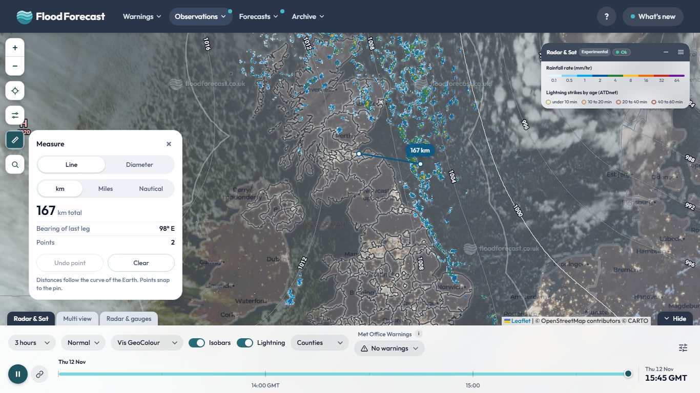
Two new buttons sit at the foot of the map buttons on the radar and model pages. Search finds a town or postcode and drops a pin, or use your location, or press and hold anywhere on the map. Measure draws a line to give the distance and bearing, or choose Diameter to click a centre and an edge and read the radius, diameter and area. Distances can be in km, miles or nautical miles, and points snap to your pin.
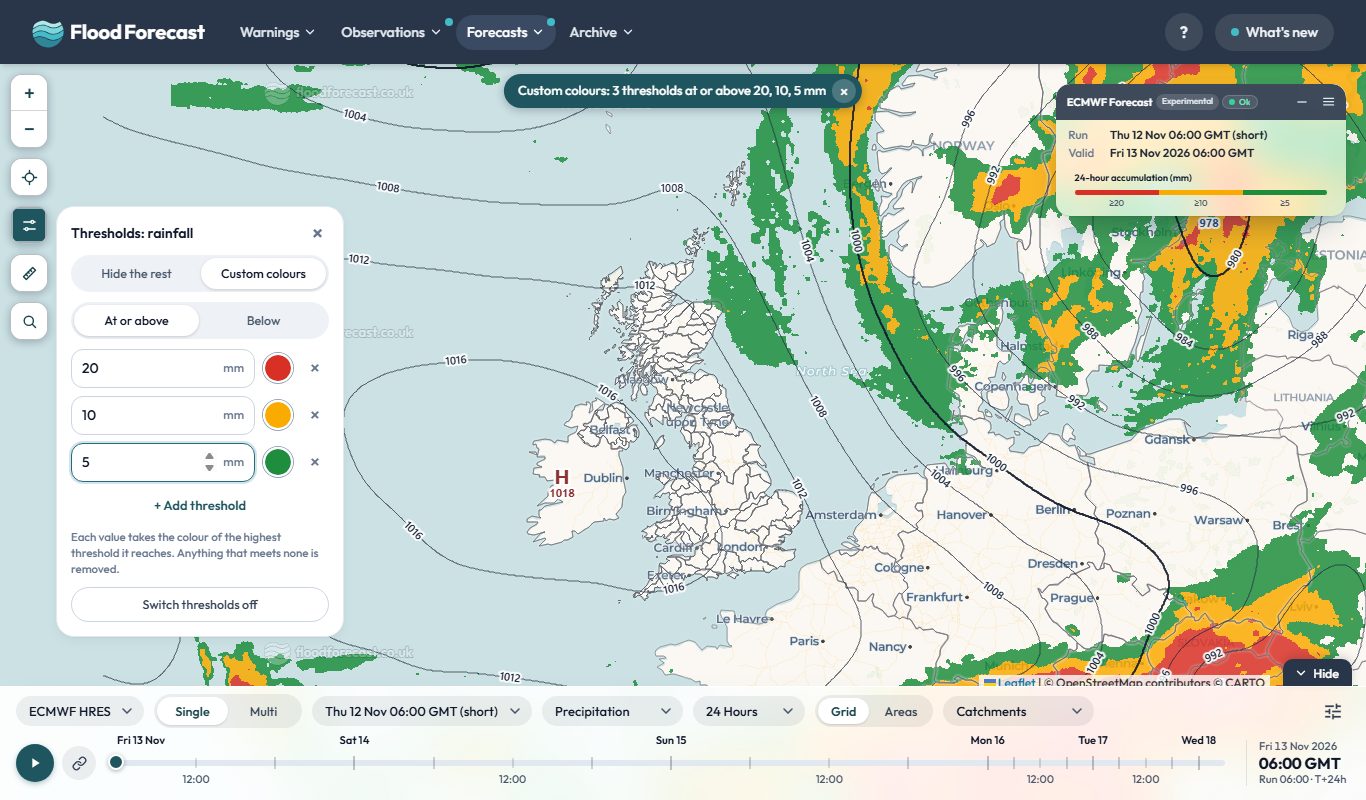
A new button under the zoom buttons lets you set a level and show only what meets it, such as rain at or above 30 mm or gusts below a given speed. Or choose Custom colours to give each level its own colour, for example red from 30, amber from 20 and green from 10. A pill at the top of the map says when thresholds are on, and the key shows your levels. It works on weather observations, the Model Viewer and Model Multi (rain and wind), Radar and Radar Accumulation.
A new homepage: what has happened, and what is coming
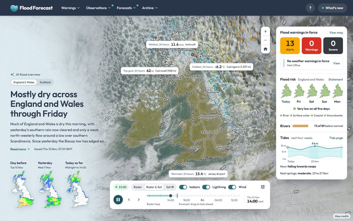
The homepage now reads as a timeline. The live radar and satellite loop leads, and you can drag its slider past now into the next 24 hours of Met Office UKV forecast rain. The wettest gauge, top gust and warmest and coldest places of the last 24 hours are pinned on the map where they happened. Below, Recent history covers rainfall, river levels, observations, the week's flood warnings and how wet the ground is, and Look ahead sets out the next five days: flood risk, warnings, rain and peak gusts from several models, the tides, and whether the models agree.
This application brings together real-time data from multiple sources to help you stay
informed about weather and flood conditions across the UK.
report_problem
Important
This application is unofficial and provided for informational, research, and analysis purposes only. Uptime, data completeness, and real-time accuracy are not guaranteed.
To avoid over-reliance during active weather or flood events, do not make safety-critical decisions using this tool. For official warnings and instructions, consult the primary public services directly:
Google Analytics is used to see which pages are useful and where the site is slow. It's off until you say otherwise, and your choice is remembered. Nothing else on this site sets non-essential cookies, and advertising or personalisation cookies are never allowed.
Analytics is currently on.
You can change this at any time from the Cookie preferences link in the page footer.
 Open Radar & Sat